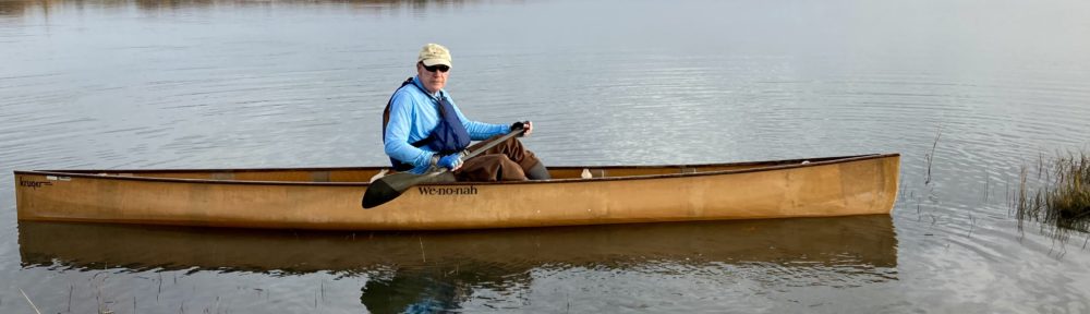
My favorite local paddle is the East River, a tidal river that empties into the Long Island Sound in my town of Guilford, Connecticut. For most of its length of about five miles it runs through a salt marsh complex. The upper section goes through coastal woodland.
I access the river from a state boat launch at its mouth. Most of the boat traffic from the launch is trailered power craft heading into the Sound, but a number of paddlers use the launch to explore the marsh or to kayak into the Sound.
i usually aim to hit the water about an hour before high tide. I’ll paddle with the tide upriver and then head back down to the boat launch on the ebb. The wind over the marsh tends to have a greater effect one way or the other on a paddler’s progress than the tide, but the river is not deep, and low tide exposes rocks and sunken tree limbs that I would have to avoid with my canoe. Paddling at high tide also allows for forays from the river into interesting side channels, some of which have little or no water at low tide.

I’m not an expert on marsh vegetation, but the East River is a scenic paddle at any time of year. The length of the view from the seat of a canoe depends somewhat on the season and the height of the spartina grass, phragmites and cattails. Paddling at high tide, of course, lets one see over the tops of marsh grasses that would block the view at low water.
Paddling away from the boat launch one heads mainly north up the winding river, which, if I had to guess, is 20 to 30 yards wide in its lower stretches.
As you paddle along, you can see the old narrow drainage ditches entering the river. If you look at a New England salt marsh on Google Maps, you can usually see the parallel drainage ditches. I found this description of the history:
Salt marshes in an historical context, within the New England States, were highly valued by early colonists for salt hay and aesthetics. In time these values diminished with the introduction of European grasses and industrial development. Many marshes were eventually filled to accommodate development, maintain navigation channels and heavily ditched to promote agriculture and control mosquito populations. Following the great depression, rational methods, such as seasonal surveys and breeding connectivity studies were abandoned in favor of large scale parallel ditching that today dominates the landscape of our Atlantic Coast marshes. Unskilled laborers dug ditches in a grid pattern to effectively drain the marsh. Aside from being unaesthetic, these practices are detrimental to marsh structure and function.
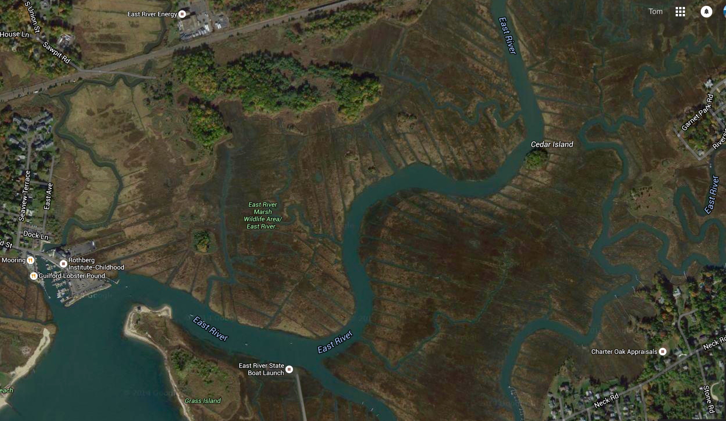
map of mouth of East River
The effects of man’s local and global meddling on salt marshes aside, there is plenty of birdlife to be enjoyed on the river. Osprey are abundant in the summer. A number of substantial nesting platforms have been erected along the river (I helped put one up a couple of years ago at a nearby state park) and I rarely see one unoccupied by osprey during the nesting season. Spending any time on the river will allow you to see an osprey make its spectacular dive, bring up a fish, and arrange it in its talons to cut the wind resistance of the still-alive meal as the osprey flies off to a nesting platform. I spot bald eagles now and then, and once saw an opportunistic eagle make an osprey on the wing surrender its catch, which the eagle then caught in the air. Great and snowy egrets, and plenty of herons (great blue, green, and black-crowned and yellow-crowned night species) patrol the river’s banks. One can also spot glossy ibis and oystercatchers and many types of sandpiper, including numerous willet that will scold you as you cruise by their nests. The white-rumped northern harrier of marsh and field is also common, as are kingfishers that perch in the trees overhanging the upper river, and marsh wrens that live in the reeds. Threatened saltmarsh sparrows also nest along the river. Double-crested cormorants will dive and surface as you paddle along. Among the non-bird life, a paddler will see plenty of diamondback terrapins in the water, or at least their heads until they submerge at the sight of the paddler. You can also spot the terrapins sunning on the riverbank. In summer one will also encounter large schools of menhaden or bunker finning in the water.

There are five bridges one paddles under during the course of heading up the river. The first one, about 1.5 miles from the mouth of the river, is a railroad bridge that brings Amtrak and other trains over the water. The beauty of this bridge for the paddler is that it is too low for motorboats of any size to get by, and you won’t encounter anything but a small craft with an outboard beyond this bridge.
A bit after the railroad bridge, the marsh gives way a bit to higher ground and you paddle under the Post Road, U.S. 1. Depending on the season, you might encounter people fishing or trying to catch blue crabs from the span. Just past the Post Road bridge is a restaurant, aptly called “Friends,” that lets paddlers use its parking lot and launch into the river. I’ve put in here a number of times, but in recent years I take longer paddles from the boat launch at the river’s mouth.
Not far upstream from Route 1, Interstate 95 crosses the river. On a hot summer day, the shade under the bridge gives a short respite. Upon passing the Route 1 and I-95 bridges, I check the bridge pilings to determine the direction of the current and tide height.
Past I-95, the marsh opens again and the view lengthens. There are also some houses set back from the river and several docks for paddlecraft or small motorboats. I find myself alone on the river way more often than not, however, regardless of the season. Only on a late summer weekend will I see more than a couple of other paddlers.
About three-and-three-quarter miles from the mouth of the river, the paddler goes under a fairly low arched stone bridge that carries a country road over the flow. I have caught snapper bluefish on a fly rod by the bridge, which narrows and speeds the flow of water in either direction depending on the tide and creates small eddies where the bluefish wait for prey.

I was paddling just below the stone bridge one day in May and heard a voice that seemed to be coming from the heavens telling me to put on my life jacket. A state conservation officer happened to be driving over the bridge and reminded me through a bullhorn that a PFD was mandatory before Memorial Day.
There is a National Audubon Society sanctuary on the bank of the river just downstream from the bridge.
Beyond the stone bridge, the upper river marsh has woods and fields on the higher ground, including Guilford’s 600-acre East River Preserve, a large preserve with walking trails on one bank. It’s the quietest section of the river, and features some wide, still pools that look like ponds. The water has changed here from salt to brackish.

After the pools, the river narrows and trees close in on either side. There is one last bridge to float below, a small structure, now only open to foot traffic, within the preserve. Once past this small bridge, paddling involves the occasional duck under a low limb, as well as some draw strokes with the paddle to make turns in the tight quarters of the upper river. Five miles from its mouth, the fully-shaded river peters out for paddlers, who come to a tangle of limbs and brush that end further passage. It is time to reverse course and head back downstream, perhaps with the ebbing tide as an added push.

Another river that empties into the Sound alongside the East River is the Neck River. Shorter and narrower, the Neck River is also a good paddle, and is also accessed from the same boat launch. One morning in May, the only other person at the boat launch when I arrived was a paddler with a canoe similar to mine. He told me that at high tide one could paddle from the Neck River to the East River via a “sneak” or small connecting channel that meanders through the marsh grass. I’ve since found the “sneak” (It’s not always easy to locate amid the other small channels that appear at high tide), and it’s a good alternative from time to time to the lower stretch of the East River.